

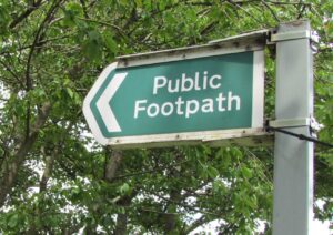
5 years ago we were warned – log your favourite footpath or loose it in 5 years time. That 5 years has passed and the warning has been extended to another 5 years = 2031:-
Under section 56 of the Countryside and Rights of Way Act 2000 (The CROW Act 2000), footpaths and bridleways that are not recorded on the Definitive Map by 1 January 2031, that have only been classified as a footpath or bridleway and that were in use before 1949 will automatically be stopped up on that date.
Interactive Map and Definitive Map
If you love looking at maps, have a look at the layers on the Surrey County Council’s interactive map – it’s fascinating – shows green belt, sites of special scientific interest and many more – including named footpaths. click here
https://www.surreycc.gov.uk/land-planning-and-development/interactive-map
There’s lots more information about the Definitive Map on SCC website – just click here
Please check the definitive map. It is important that Cranleigh people who regularly walk various routes do so – if your routes are shown then that’s great, but if not – we need to get them registered as proper footpaths – as soon as we can.
Public Right of Way
“A public right of way is a public highway. In law a public right of way is part of, and connects
with, the wider highway network. Although they are mainly in the countryside, there are public
rights of way in towns and villages too. Together, we call this the public rights of way network.
There are four types of public right of way:
Public footpaths – a public right of way only for pedestrians (including dog walkers,
users of wheelchairs, mobility scooters and people with buggies)
Public bridleways – same users as public footpaths, and in addition can be used by
horse riders and cyclists
Restricted byways – same users as public footpaths and bridleways, and in addition
can be used by horse-drawn carriage drivers
Byways Open to All Traffic – a public right of way for all users, including motor
vehicles” https://www.surreycc.gov.uk/__data/assets/pdf_file/0008/409697/Rights-of-Way-Improvement-Plan-2025-to-2035.pdf
Found an UNNAMED route you love? – Cranleigh Society would like to take a walk with you – get in touch with Trevor – via this email –
membership@cranleighsociety.org

screen shot of Surrey County Council’s interactive map showing many layers
It will be a great help if anyone knows little-used footpaths, but please check the map and let us know at Cranleigh Society.